Svenska
Svenska
English
Min meny
Mitt konto
Mina favoriter (0)
Varukorg
Kassa
Blogg & Tips
Välkommen! Du kan
logga in
eller
skapa konto
.
0 produkter - 0,00kr
0
Din varukorg är tom!
Stäng
Välkommen! Du kan
logga in
eller
skapa konto
.
Hem
Mina favoriter (0)
Mitt konto
Kassa
Kartor
KARTOR EUROPA
Albanien
Alperna
Andorra
Baltiska staterna
Belgien
Bosnien Hercegovina
Bulgarien
Cypern
Danmark
Cykel- och vandringskartor Danmark
Kartor - atlaser
Estland
Europa - Norden
Guider - handböcker
Kartor - vägatlaser
Finland
Frankrike
Delkartor IGN 1:100 000
Delkartor Michelin
Kartor - atlaser
Grekland
Irland
Island
Italien
Delkartor Marco Polo
Delkartor Michelin
Kartor - atlaser
Kosovo
Kroatien
Lettland
Litauen
Luxemburg
Makedonien
Malta
Moldavien
Montenegro
Nederländerna
Norge
Calazo Fjällkartor Norge
Kartor - Atlaser
Turkartor
Österrike
Polen
Portugal
Rumänien
Schweiz
Serbien
Slovakien
Slovenien
Spanien
Delkartor Michelin
Kartor- atlaser
Stadskartor
Storbritannien
Delkartor 1:50 000
Delkartor AA
Delkartor Michelin
Kartor - atlaser
Tjeckien
Tyskland
Delkartor Marco Polo
Delkartor Michelin
Kartor- atlaser
Tyskland Cykelkartor
Ukraina
Ungern
Vitryssland
KARTOR ÖVRIGA VÄRLDEN
Afrika
Algeriet
Angola
Benin
Botswana
Burkina faso
Burundi
Centralafrikanska Republiken
Comorerna
Djibouti
Egypten
Elfenbenskusten
Eritrea
Etiopien
Gabon
Gambia
Ghana
Guinea
Guinea - Bissau
Kamerun
Kap Verde
Kenya
Kongo (Dem. Rep.)
Kongo (Rep.)
Lesotho
Libyen
Madagaskar
Malawi
Mali
Marocko
Mauretanien
Mauritius
Mocambique
Namibia
Niger
Nigeria
Reunion
Rwanda
Senegal
Seychellerna
Sierra Leone
Somalia
St Helena
Sudan
Swaziland
Sydafrika
Tanzania
Tchad
Togo
Tunisien
Uganda
Zambia
Zimbabwe
Asien - Mellanöstern
Afghanistan
Armenien och Azerbajdzjan
Bangladesh
Bhutan
Filippinerna
Georgien
Indien
Indonesien
Irak
Iran
Israel
Japan
Jordanien
Kambodja
Kazakstan
Kina
Kirgizistan
Kuwait
Laos
Libanon
Malaysia
Mongoliet
Myanmar(Burma)
Nepal
Nordkorea
Oman och Förenade Arabemiraten
Pakistan
Qatar
Ryssland
Saudi Arabien
Sri Lanka
Sydkorea
Sydostasien
Syrien
Tadzjikistan
Thailand
Turkiet
Turkmenistan
Uzbekistan
Vietnam
Yemen
Centralamerika - Västindien
Antigua
Aruba
Bahamas
Barbados
Barbuda
Belize
Bermuda
Bonaire
Costa Rica
Cuba
Curacao
Dominica
Dominikanska Republiken
El Salvador
Guadeloupe
Guatemala
Haiti
Honduras
Jamaica
Martinique
Nicaragua
Panama
Puerto Rico
St Lucia
Trinidad Tobago
Nordamerika - USA
Atlas och Delkartor USA
Delkartor USA Michelin
Kanada
Mexiko
Stadskartor USA
Stater och Övrigt USA
Oceanien - Antarktis
Antarktis
Australien
Nya Zeeland
Stilla Havet
Sydamerika
Argentina
Bolivia
Brasilien
Chile
Colombia
Ecuador
Guyana-Franska Guyana
Paraguay
Peru
Surinam
Uruguay
Venezuela
KARTOR SVERIGE
Atlaser-Vägkartor
Delkartor Sverige
Vägkartan 1:100 000
MC Kartor
Stadskartor - Detaljkartor
Flygkartor
Flygkartor ICAO 1:500 000
Flygkartor TMA 1:250 000
Cykelkartor
Topografiska kartor
OUTDOORKARTAN - KUNGSLEDEN
Sverigeserien - Topo50
Calazo
Fjällkartan 1:100 000
Fjällkartan 1:50 000
Outdoorkartan
Terrängkartan
Utekartan
GPS kartor
VANDRINGSKARTOR - CYKELKARTOR
Europa
Calazo Norge - Danmark - Finland
Kompass (Europa)
Tabacco (Italien)
Walter Mayr XL (Österrike)
Norge Turkartor
Danmark Cykelkartor
Frankrike delkartor IGN 1:100 000
Storbritannien delkartor 1:50 000
Tyskland Cykelkartor och guider
Sverige
Outdoorkartan - Kungsleden
Cykelkartor
Outdoorkartan
Fjällkartan 1:100 000
Fjällkartan 1:50 000
Calazo
Sverigeserien Topo50
Terrängkartan
Utekartan
GPS Kartor
Reseguider - Böcker
VANDRING - FRILUFTSGUIDER
Afrika
Asien
Europa
Nordamerika och Arktis
Sverige
Sydamerika
VÄRLDSATLASER - FAKTABÖCKER
Världsatlaser
Faktaböcker
Sveriges Nationalatlas SNA
RESEGUIDER
Afrika
Asien
Centralamerika
Karibien
Europa
Europa - Norden
Albanien
Andorra
Belgien
Bosnien Hercegovina
Bulgarien
Cypern
Danmark
Estland
Finland
Frankrike
Grekland
Irland
Island
Italien
Kosovo
Kroatien
Lettland
Litauen
Luxemburg
Makedonien
Malta
Moldavien
Montenegro
Nederländerna
Norge
Polen
Portugal
Rumänien
Ryssland
Schweiz
Serbien
Slovakien
Slovenien
Spanien
Storbritannien
Sverige
Tjeckien
Turkiet
Tyskland
Ukraina
Ungern
Vitryssland
Österrike
Nordamerika
Oceanien
Sydamerika
Hotell och Restaurangguider
Parlörer - Ordböcker
Väggkartor
VÄGGKARTOR
Världskartor
Världsdelar
Länder och Regioner
Sverige
Stockholm
Monterade Kartor
Reliefkartor
Historiska kartor
Skrapkartor - Scratch Map
Vinkartor
Stjärnor och planeter
Temaposter
Tillbehör - Kartnålar
HISTORISKA KARTOR
JORDGLOBER
JORDGLOBER
UPPBLÅSBARA JORDGLOBER
HANDGJORDA JORDGLOBER
Barn - Rymden
BARN OCH FAMILJ
Böcker - Atlaser
Prylar
Pussel - Spel - Pyssel
Väggkartor
STJÄRNOR OCH PLANETER
Nautiskt
SJÖKORT - NAUTISKT LITTERATUR
Sjökort Sjöfartsverket
Sjökort Hydrographica
Båtsportkort Sverige
Båtsportkort Danmark
Båtsportkort Finland
Båtsportkort Medelhavet
Båtsportkort Polen - Litauen
Tillbehör och Litteratur
Nautiskt tema
SVENSKA - SJÖARKIVET
Västkusten
Ostkusten
Övriga sjökortsmotiv
Pussel - Inredning
INRED MED KARTOR
Bordstabletter - Servetter
Brickor
Övrig Inredning
KARTPRYLAR - VYKORT - 3D KORT
Kartprylar
Vykort - 3D Kort
PUSSEL - SPEL - PYSSEL
Pussel
Pyssel
Spel
Tillbehör
FRILUFTSPRYLAR
KOMPASSER - KARTFODRAL
Kartfodral - tillbehör
Kompasser
RESETILLBEHÖR
Resetillbehör
Din egen karta
Meny
Kartor
KARTOR EUROPA
Albanien
Alperna
Andorra
Baltiska staterna
Belgien
Bosnien Hercegovina
Bulgarien
Cypern
Danmark
Estland
Europa - Norden
Finland
Frankrike
Grekland
Irland
Island
Italien
Kosovo
Kroatien
Lettland
Litauen
Luxemburg
Makedonien
Malta
Moldavien
Montenegro
Nederländerna
Norge
Österrike
Polen
Portugal
Rumänien
Schweiz
Serbien
Slovakien
Slovenien
Spanien
Storbritannien
Tjeckien
Tyskland
Ukraina
Ungern
Vitryssland
KARTOR ÖVRIGA VÄRLDEN
Afrika
Asien - Mellanöstern
Centralamerika - Västindien
Nordamerika - USA
Oceanien - Antarktis
Sydamerika
KARTOR SVERIGE
Atlaser-Vägkartor
Delkartor Sverige
Vägkartan 1:100 000
MC Kartor
Stadskartor - Detaljkartor
Flygkartor
Cykelkartor
Topografiska kartor
VANDRINGSKARTOR - CYKELKARTOR
Europa
Sverige
Reseguider - Böcker
VANDRING - FRILUFTSGUIDER
Afrika
Asien
Europa
Nordamerika och Arktis
Sverige
Sydamerika
VÄRLDSATLASER - FAKTABÖCKER
Världsatlaser
Faktaböcker
Sveriges Nationalatlas SNA
RESEGUIDER
Afrika
Asien
Centralamerika
Europa
Nordamerika
Oceanien
Sydamerika
Hotell och Restaurangguider
Parlörer - Ordböcker
Väggkartor
VÄGGKARTOR
Världskartor
Världsdelar
Länder och Regioner
Sverige
Monterade Kartor
Reliefkartor
Historiska Kartor
Skrapkartor - Scratch Map
Vinkartor
Stjärnor och planeter
Temaposter
Tillbehör - Kartnålar
HISTORISKA KARTOR
JORDGLOBER
Jordglober
Uppblåsbara jordglober
Handgjorda Jordglober
Barn - Rymden
BARN OCH FAMILJ
Böcker - Atlaser
Prylar
Pussel - Spel - Pyssel
Väggkartor
STJÄRNOR OCH PLANETER
Nautiskt
NAUTISKT - SJÖKORT
Sjökort Sjöfartsverket
Sjökort Hydrographica
Båtsportkort Sverige
Båtsportkort Danmark
Båtsportkort Finland
Båtsportkort Medelhavet
Båtsportkort Polen - Litauen
Tillbehör och Litteratur
Nautiskt tema
Pussel - Inredning
Användningsområde
Brickor
Dukning
Jordglober
Kartprylar
Övrig inredning
Pussel
Pyssel
Spel
Vykort
INRED MED KARTOR
Bordstabletter - Servetter
Brickor
Övrig Inredning
KARTPRYLAR - VYKORT - 3D KORT
Kartprylar
Vykort - 3D Kort
PUSSEL - SPEL - PYSSEL
Pussel
Pyssel
Spel
Tillbehör
FRILUFTSPRYLAR
KOMPASSER - KARTFODRAL
Kartfodral - tillbehör
Kompasser
RESETILLBEHÖR
Resetillbehör
Din egen karta
Hem
»
Pretoria Pocket Map Studio
Nyligen tillagda
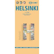
Helsingfors stadskarta Borch
139,00kr
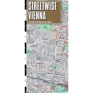
Wien stadskarta Streetwise
95,00kr
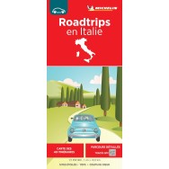
Italien Roadtrips Michelin
135,00kr
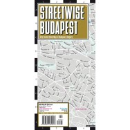
Budapest stadskarta Streetwise
95,00kr
Seoul Första Klass Pocketguider Topp 10
159,00kr
Pussel Donut Lover´s 1000 bitar
295,00kr
Pussel House Plants 1000 bitar
295,00kr
Pussel Dog Lover´s 1000 bitar
295,00kr
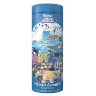
Pussel Ocean Lover´s 1000 bitar
295,00kr
Pussel Street Food 1000 bitar
295,00kr
Pretoria Pocket Map Studio
Pretoria Pocket Map Studio
Art.nr:
9781776170067
Tillgänglighet:
I lager
Pris:
149,00kr
Exkl.moms:
140,57kr
Tags:
Sydafrika
,
Lägg till i favoriter
Dela
Beskrivning
Map Studio skala 1:12 500
Stadskarta över samt karta över Pretoria med omgivningar
Ring oss:
(+46) 08-202 303
Nyhetsbrev: